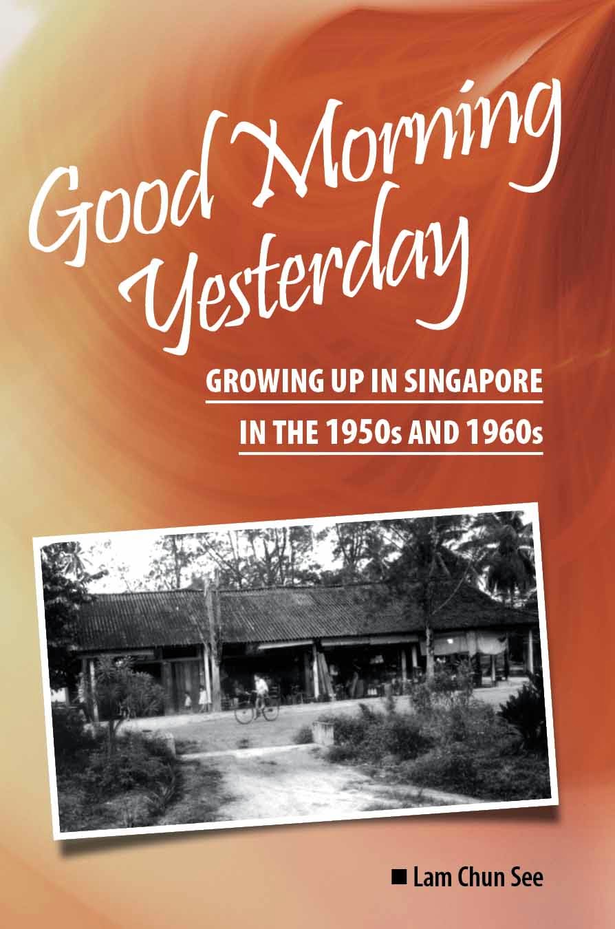
Below are two photos from Geoff Pain. They were taken in the mid-60’s. Can you help me to identify the location please? It is likely to be in the Upper Serangoon/Bartley/Paya Lebar vicinity? Thanks.


"Good morning yesterday. You wake up, and time has slipped away. And suddenly it's hard to find, the memories you left behind. Remember. Do you remember?" - Paul Anka, Times of Your Life


9 comments:
could it be in the sommerville road and jalan lateh area? i think today, it is called daisy park. i used to visit a friend who lived there.
I guess it should be around upper serangoon area.
There are some prominent landmarks in both of the photos. The first one has what appear to be barracks or quarters of some sort in the background. The second one has a large government-looking building with a flag at the right background, and another building that appears to be a chinese temple to the right of the govt building. Unfortunately I can't recognise any of them. Anyone have a clue ? Gurkha encampment ? Paya Lebar police station ?
Could the large building be the Ramakrishnan home along Bartley Road? It looks like it with its low wall surrounding the main building. The picture could have been taken from the vicinity around Bartley Sec School.
Joseph is probably right. Geoff Pain used to live in Eden Grove. A friend who lived in that area said the this photo was probably taken from Eden Grove and the kampong in the photo was Jalan Rindu.
"Eden Grove is on a hill top and Jalan Rindu much lower.
In those days, the Jalan Rindu area are all atap houses, a kampong area. It's opposite the cemetery, along Bartley Road."
chun see
so my cousin was right after all? That fella good for Seletar, Yio Chu Kang and Lorong Tai Seng.
I want to use one of these photos in my book to illustrate what a kampong in Spore looked like. Which one should I use?
I think No 2 give a better overall view.
Yes, most probably taken from Eden Grove or even along Upper Serangoon Road near the present Blk 401/407. I think the second picture shows the back portion of Ramakrishnan Home judging from the orientation of the temple. That temple could be Jin Long temple at the top of Lorong How Sun.
My cousin old me:
In the 2nd photo, this place is also very likely within the Jalan Rindu area but more towards Bartley Road/Upper Paya Lebar Road junction.
There was an old road called Lorong A-Leng (no longer around, I think because of redevelopment). Lorong A-Leng is near the temple in the photo, very close to Quemoy Road.
Post a Comment